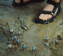

Armies of soldier crabs scurried about in tidal flats during low tide near Dunwich on North Stradbroke Island.
2. Studies of zonation of marine animals in the intertidal zone. This involved data collection (primarily species counts) using quadrats along a perpendicular to the shoreline. Later analysis of these data with "kite diagrams" and species richness and diversity measures showed how the distribution of species changes in the region from the low to high water lines.
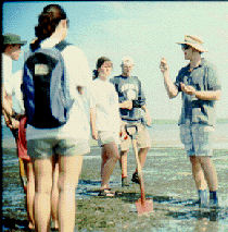
Marine zoologist Ian Tibbetts of the University of Queensland leads a discussion in the intertidal zone on North Stradbroke Island.
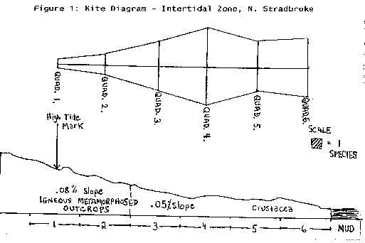
A kite diagram drawn by John Muhlfeld '95 shows species richness by location in the intertidal zone at Dunwich on North Stradbroke.
3. A visit to a large sand mining company (Consolidated Rutile Ltd) on the island gave students the opportunity to see the recent history of a variety of land rehabilitation schemes. The sands of the island are mined because they are rich in rutile, zircon, and ilmenite.
4. Data collection using point-centered quadrat methods to determine relative density, basal area, and cover at two sites at Brown Lake were used to illustrate successional stages in fire-adapted forests.
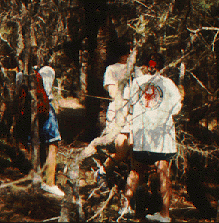
Gathering data along a 100m transect pertaining to tree species distribution and size at Brown Lake.
5. Data collection to create species-area curves at a sand dune site and a forest site illustrated the problem of how the minimum sampling area changes with habitat.
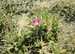
A succulent whose common name is "pig face" is a pioneer species in many dune areas.
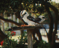
Phylum: Chordata
Class: Aves
Family: Alcedinidae
Species: Dacelo gigas
"Laughing Kookaburra"
This pair of kookaburras kept us company at the motel where we stayed. Kookaburras are one of the world's largest kingfishers. Their song is an unforgettable boisterious laugh: "kook-kook-kook-ka-ka-ka"
The level of aquatic life in Moreton Bay is determined by the extent of the supporting habitat and environment. This is why the preservation of seagrasses, mangrove forests, water quality, and several other factors is crucial within the embayment. Because Moreton Bay is a closed waterway, certain factors influence the degree at which this environment can support marine life: commercial and urban development; dam and canal construction; effluent disposal; pollution; and human encroachment into adjacent or associated waterways and their hinterlands (Williams, Lew. "Moreton Bay Fisheries", Australian Littoral Society, Inc., 1984).
Fisheries' biodiversity and productivity is influenced by the relative size, area and location of mangrove forests, seagrass meadows, reefs, sand and mud banks, beaches and the associated input of nutrients from river systems (Williams, Lew 1992). Through the analysis of catchment data from both local and commercial fisheries, it is possible to roughly determine the biodiversity of marine life in Moreton Bay. Common techniques used by these fisheries are the trawler, plankton net, and the line and trap. Also, due to the long history of fishing in Moreton Bay, records reflect that the Bay supports a wide diversity of marine fishes and organisms.
Trawler data was collected on 18/4/94 by a group of students from Hobart and William Smith Colleges. Moreton Bay trawlers land 10% of the Queensland trawl catch, roughly 41% of the total Moreton Bay production, thus trawler data can be used to reflect some sort of marine productivity.
The trawl conducted on 18/4/94 was done on the eastern portion of Moreton Bay off the western coast of North Stradbroke Island at a depth of 24 ft. for thirty minutes. The net was dragged off the starboard side into the current. Conditions were calm during the trawl that began at 6:56 p.m. and ended at 7:26 p.m.
Thirty-one species of marine organisms were caught with a total population of 379 individuals. Thus, species richness for this particular trawl was 31. To determine the way in which the 379 individuals were distributed among the 31 species, Hmax and the Shannon-Weiner Index H1 were used. An evenness of 0.642 was calculated. The fact that H1 is relatively high reflects that the total numerical abundance of individuals in this trawl was more evenly distributed among the thirty-one species caught than unevenly. Thus, equitability is increased for this particular trawl.
Trawler Data Biodiversity
Results: Species = 31, individuals = 379. H1 = 0.957 and HMax = 1.49, so the equitability = 0.957/1.49 = 0.642.
It is important to note however that trawl data is biased in several ways: 1) the time at which the trawl occurs; 2) depth of the nets; 3) location of the trawl; 4) port-starboard collection; 5) flooding or ebbing tide; and 6) direction of wind and water currents. Taking into account these various biases, it is evident that a change in only one is enough to dramatically alter the trawl data.
A more accurate description of the biodiversity and productivity of Moreton Bay can be made using data acquired by local commercial fisheries. According to recent data, Moreton Bay produces 3,200 tonnes of seafood per year. This amounts to roughly 13% of Queensland's annual catch, and does not include the additional 2,000 tonnes of finfish caught by large recreational fisheries. Queensland's commercial fishery is estimated to have a G.V.P. of roughly 200 million dollars per year, 10% of which comes from Moreton Bay commercial fisheries. The following list represents the contribution of Moreton Bay to the total number of organisms caught in Queensland:
While this level of production may stand true today, there is no doubt that sustaining such an ecologically productive bay in the future will not succeed if certain anthropogenic pressures are not reduced in and around the embayment system. Presently, the Moreton Bay region has an urban population of 1.65 million, which is expected to rise to three million by the year 2020. With such a population explosion expected, the future of the bay appears grim unless stringent restrictions and environmental safeguards are implemented. In order to accomplish this it is necessary to assess exactly which human activities effect the ecological components of Moreton Bay.